
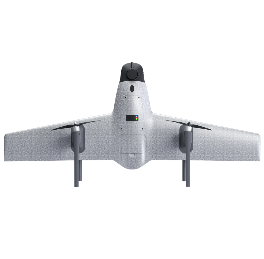
VTOL Mapping Drone – By hequavtech.com
With the innovation of technology merging with the aviation field, we have entered an era full of potential and possibilities. Drones, as outstanding representatives of modern technology, are leading the development of multiple industries with their wide range of applications, efficient performance, and unprecedented technological breakthroughs. Among them, the field of surveying stands out as a highlight of drone applications. In this article, we will introduce a highly anticipated mapping drone, the SWAN K1 MAPPING, which with its high precision, efficiency, and versatility, is becoming a leader in the surveying field.
Accurate Surveying with Guaranteed Data
Traditional surveying methods are often constrained by factors such as terrain and weather, limiting the accuracy of surveying data. However, with the rapid development of drone technology, the SWAN K1 MAPPING introduces vertical takeoff and landing along with one-touch switch flight modes, the take-off mode of VTOL makes surveying and mapping no longer restricted by terrain,combined with no rudder control technology, achieving precise flight control. Its simple control method allows users to focus more on data collection and analysis, without worrying too much about the complexity of flight control. Moreover, its centimeter-level mapping accuracy provides strong assurance for data accuracy, making the surveying results more credible. The matching of the drone’s flight altitude with the surveying scale ensures detailed image data display and height restoration, providing a broader range of applications for surveying.
Efficient Operations, Time and Effort Saving
With the continuous increase in surveying tasks, traditional surveying methods are no longer able to meet the demands of rapid response and large-scale surveying. However, the introduction of the SWAN K1 MAPPING accelerates the pace of surveying work. Taking the example of a flight altitude of 210 meters at a scale of 1:500, its coverage area is equivalent to the work of dozens of surveyors, but it only takes a short time to complete. This efficient operational approach not only saves time and effort but also significantly reduces operating costs. Additionally, its quick disassembly and assembly design makes the deployment of the drone more agile, enabling it to be put into operation anytime, anywhere, without lengthy preparation and debugging.
Accurate Data for Wiser Decision-Making
In the field of surveying, data is the core and foundation, as well as the basis for decision-making. The SWAN K1 MAPPING is equipped with a high-resolution camera with an effective pixel count of 24.3 million pixels, and it also supports APS format cameras. This means that it can capture clearer and more accurate image data. Its PPK module ensures high-precision positioning of data, with horizontal accuracy of only 0.8 cm + 1 ppm and vertical accuracy of 1.5 cm + 1 ppm. This ensures that the collected data is more reliable, providing a solid foundation for subsequent analysis and decision-making. These high-quality data bring more possibilities to surveying, enabling decision-makers to formulate plans and strategies more wisely.
Automated Operations, Reduced Risks
The automated operation of drones makes surveying operations safer and more reliable. The SWAN K1 MAPPING supports one-touch switch flight mode during flight and can also support functions such as automatic takeoff, automatic return, etc. These intelligent designs greatly reduce the risks for operators and also reduce the occurrence of accidents. The automated operation of drones makes surveying operations smoother and more controllable. Furthermore, the SWAN K1 MAPPING’s route planning function can intelligently execute multiple route tasks during flight, enhancing surveying efficiency.
Crossing Multiple Fields, Highly Practical
The SWAN K1 MAPPING not only has strong performance in the field of surveying but also demonstrates its advantages in multiple fields. It is suitable for a wide range of applications including surveying measurements, remote inspections, power line inspections, urban planning, energy projects, road construction, and mine surveys, among many others. Its efficient and accurate characteristics make it the preferred choice for solutions in various industries. Especially in complex terrains and hazardous environments, drones can replace manual labor, reducing the risks for operators.
VTOL Mapping Drone – By hequavtech.com
With the continuous progress of technology, drones are constantly reshaping our understanding of surveying with their characteristics of high precision, efficiency, and versatility. As a leading mapping drone, the SWAN K1 MAPPING showcases a brand new surveying future—a more accurate, efficient, and intelligent surveying era. Drones will continue to lead us towards a more exciting future.